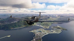
MK-Studios has shared some exclusive previews of their upcoming Greenland scenery with FSElite. Although few in numbers, the previews give a pretty good impression of what to expect from this scenery package upon release.
The main airport featured in the scenery package will be Kangerlussuaq Airport (BGSF). This airport will be recreated in high detail with high resolution custom satellite imagery that covers the airport and the city itself. The previews show a detailed apron with high quality looking models and textures, and plenty of custom objects in terms of apron vehicles and a playground for children. The scenery will also feature a detailed terminal interior, which is also visible in one of the previews.
The MK-Studios is going several steps beyond modelling just the airport itself though. The developer has also recreated Kangerlussuaq city with over 150 custom buildings. The airport and city also feature accurate elevation data based on high quality LiDAR scans.
Moving even beyond Kangerlussuaq, MK-Studios has gone through the effort of adding several more handcrafted airports to the package. The following airports are included:
- Sisimiut (BGSS)
- Maniitsoq (BGMQ)
- Qaarsut (BGUQ)
- Aasiaat (BGAA)
All of these sceneries feature custom buildings, satellite data and elevation data. One of the previews shows Qaarsut (Mittarfik Qaarsut in Greenlandic), sporting a nicely modelled custom blue terminal building and details on and surrounding the apron.
Unfortunately that’s all the MK-Studios team had to share for now, but we’ll keep you up-to-date on this nearing release.


Features
- Lifelike recreation of Kangerlussuaq Airport including detailed terminal interior
- Custom, 20cm/pixel satellite image covering the airport and the city of Kangerlussuaq
- Kangerlussuaq airport and city elevation data based on high quality LiDAR scan including runway and apron profiles
- Full rendition of Kangerlussuaq city with over 150 custom buildings
- Custom handcrafted airports: Sisimiut BGSS, Maniitsoq BGMQ, Qaarsut BGUQ and Aasiaat BGAA with custom buildings, satellite and elevation data
- Custom ground polygons with lines, dirts, markings and other details
- Realistic lighting for immersive day and night operations
- 3D snow and icebergs visible depending on weather conditions
- Custom visual effects
- AI compatible