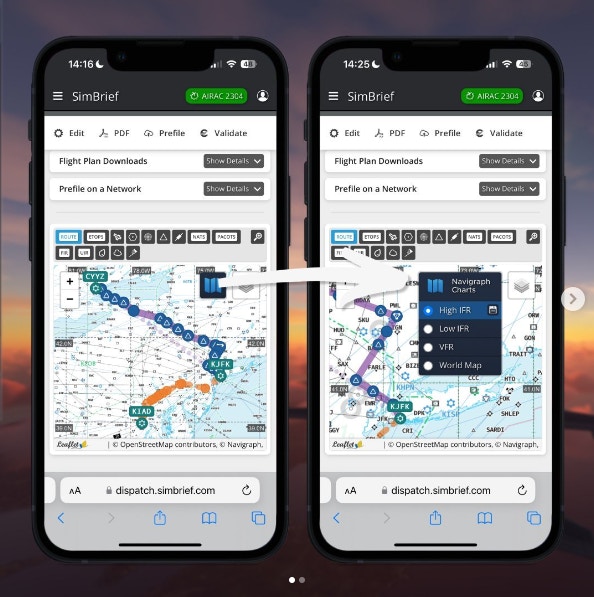
A new update to the popular flight planning application Simbrief has added the ability to view planned routes on the Navigraph interface within the Simbrief application.
The update allows pilots to view their route overlaid on any of the 4 map types (low IFR, high IFR, world map and VFR), and to zoom in for granular detail at the arrival and departure airports.

The new feature does not allow users to view charts in the Simbrief application. For that, users will still need to use the Navigraph app. This new feature is also only available to users who have a paid subscription to Navigraph.
The update was announced on an Instagram post, and generally well received by followers. In the comments, Navigraph’s team also confirmed that they are working on a way to view wind layers and live weather within the Navigraph maps interface (currently this is a Simbrief only feature), as well as adding integrated charts functionality back to the GNS 3000 and 5000 avionics systems present on aircraft such as the TBM 930 and Citation Longitude.
The new update to Simbrief is now available, with simmers needing to take no action to access the feature.


